
Features GeoSpot Pro - GPS Measurements
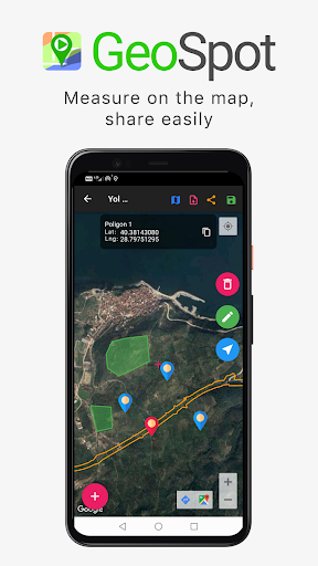
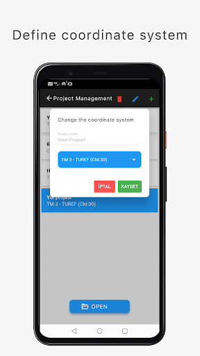
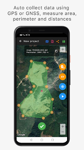
Geospot application has been developed to collect data from the field for land survey studies and Geographic Information System (GIS).Many mapping jobs such as area and distance measurement, map creation and point stake out can be easily done using GPS or GNSS.You measure in the field by defining projection types such as Geographical Coordinate System or Transverse Mercator 3° / Universal Transverse Mercator 6° in accordance with your project.You can import or share some file formats like Google Earth KML/KMZ, Netcad NCN, GEOJSON, TXT, WKT.Geospot is an easy to use and quite powerful tool.
Social Features
Connect and share with friends and the community.
Fitness Tracking
Track your workouts and monitor your health metrics.
Travel Features
Plan and manage your travels with ease.
See the GeoSpot Pro - GPS Measurements in Action
Get the App Today
Available for Android 8.0 and above